
FLAT5
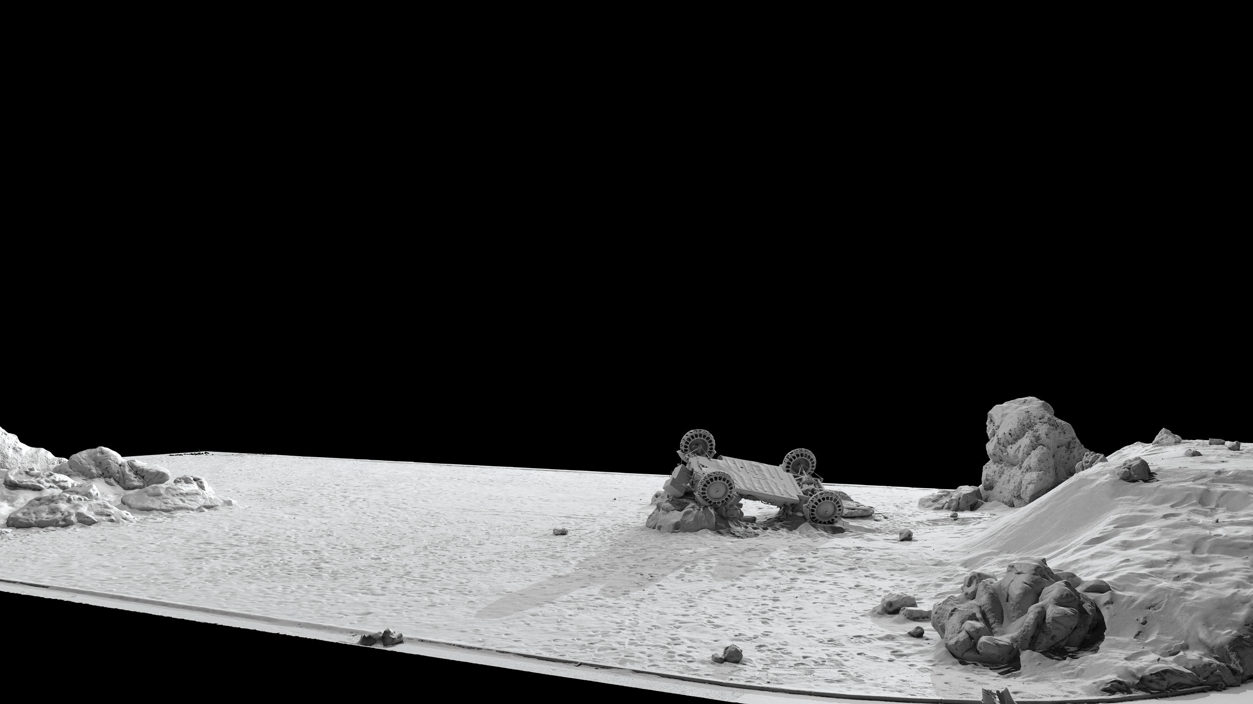
FLAT5 is a 3D scanning service, dedicated to film production. We provide set and location scanning, high-definition 3D models and photographic textures, including vehicles and props of all shapes, sizes and formats. Our workflow has been specifically developed for the VFX pipeline, with the seamless integration of laser and structured light scanners, large-scale LiDAR and mobile mapping, aerial and terrestrial photogrammetry.
Illuminating Expertise in VFX Scanning
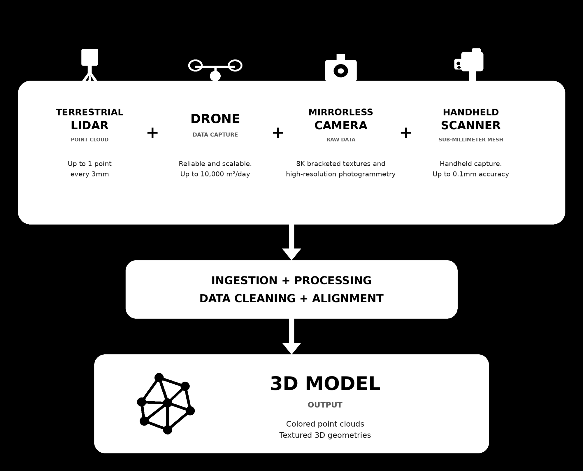
The seamless integration of FARO LiDAR point clouds, photogrammetry and high resolution bracketed textures allow us to deliver the highest quality 3D models, processing billions of polygons and hundreds of 8K textures.
We have pioneered a proprietary scanning system with multiple cameras. This Multi-Camera rig immensely reduces the time required for a survey, and allow us to compensate for the relevant occlusions / scan shadow areas that can be generated by the morphology of the buildings or by temporary obstacles. From sprawling landscapes to intricate architectural details, we can create immersive and realistic 3D environments for your virtual worlds.
Props & Vehicles
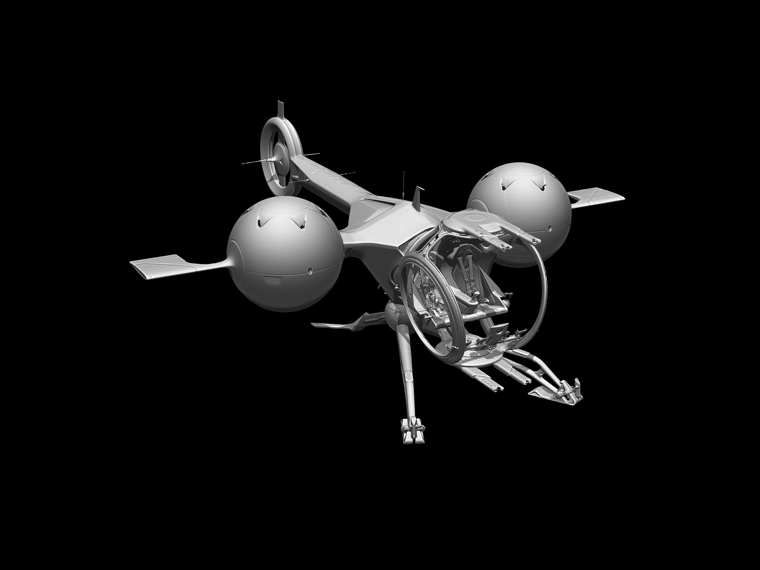
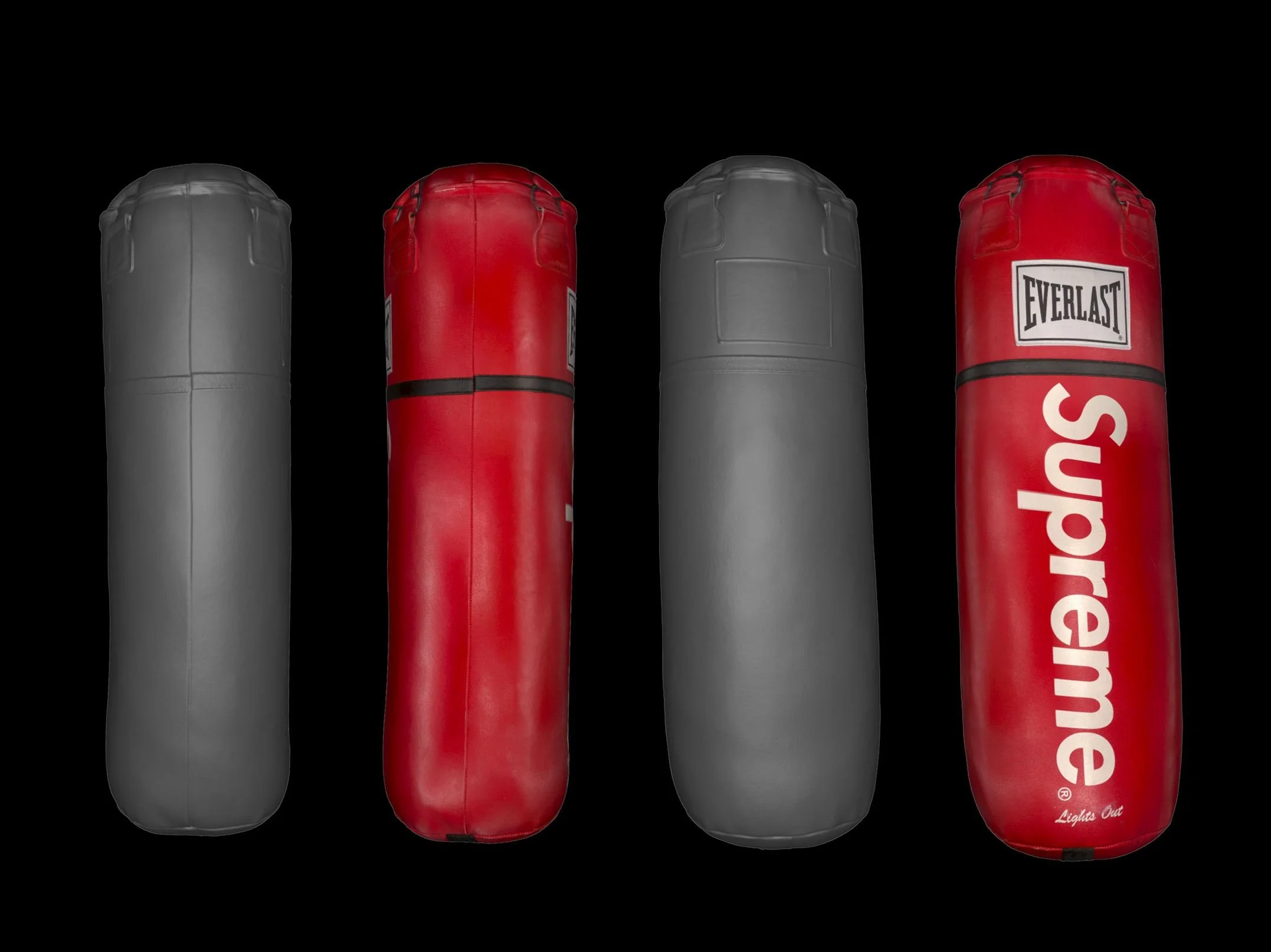
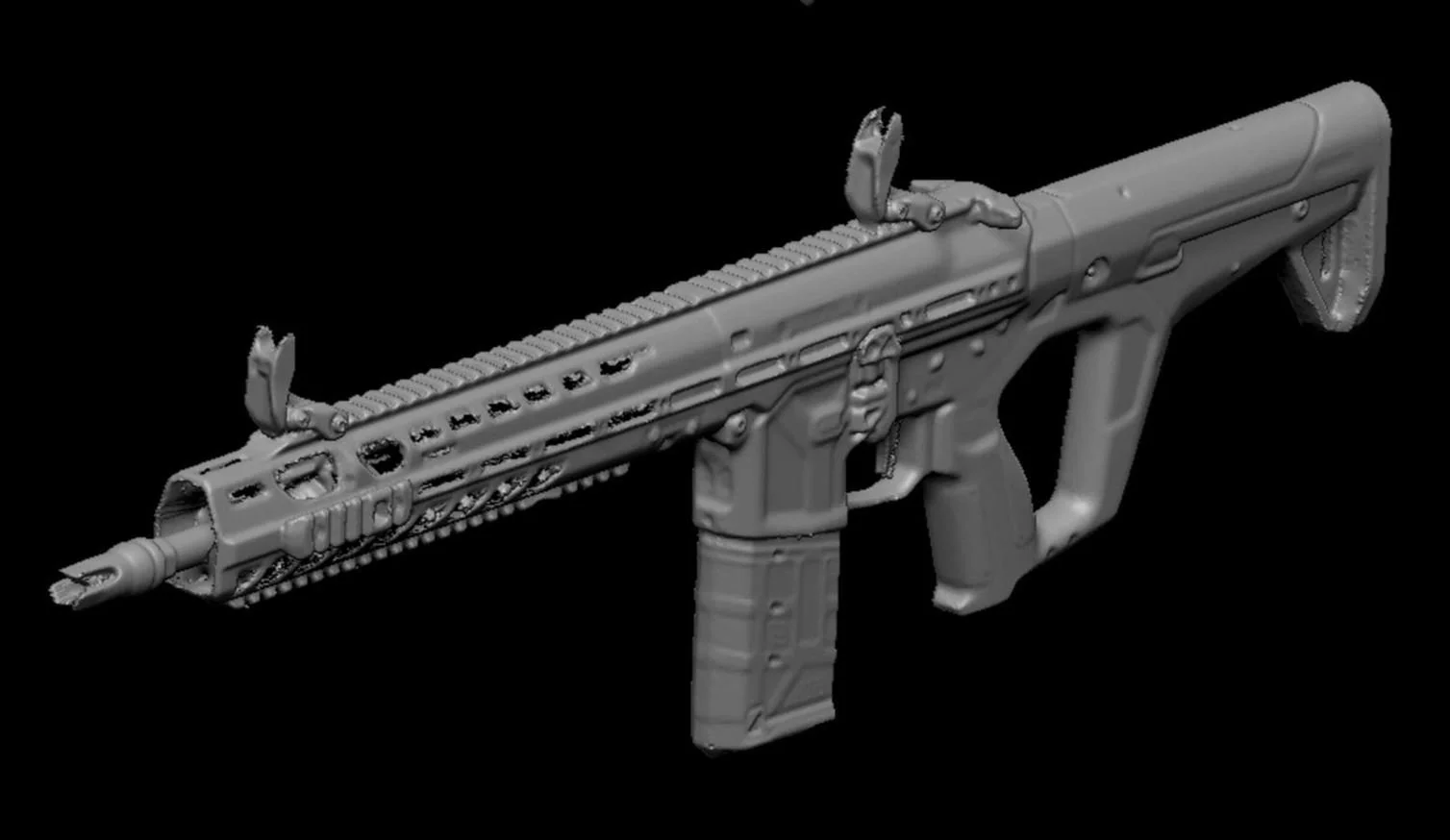
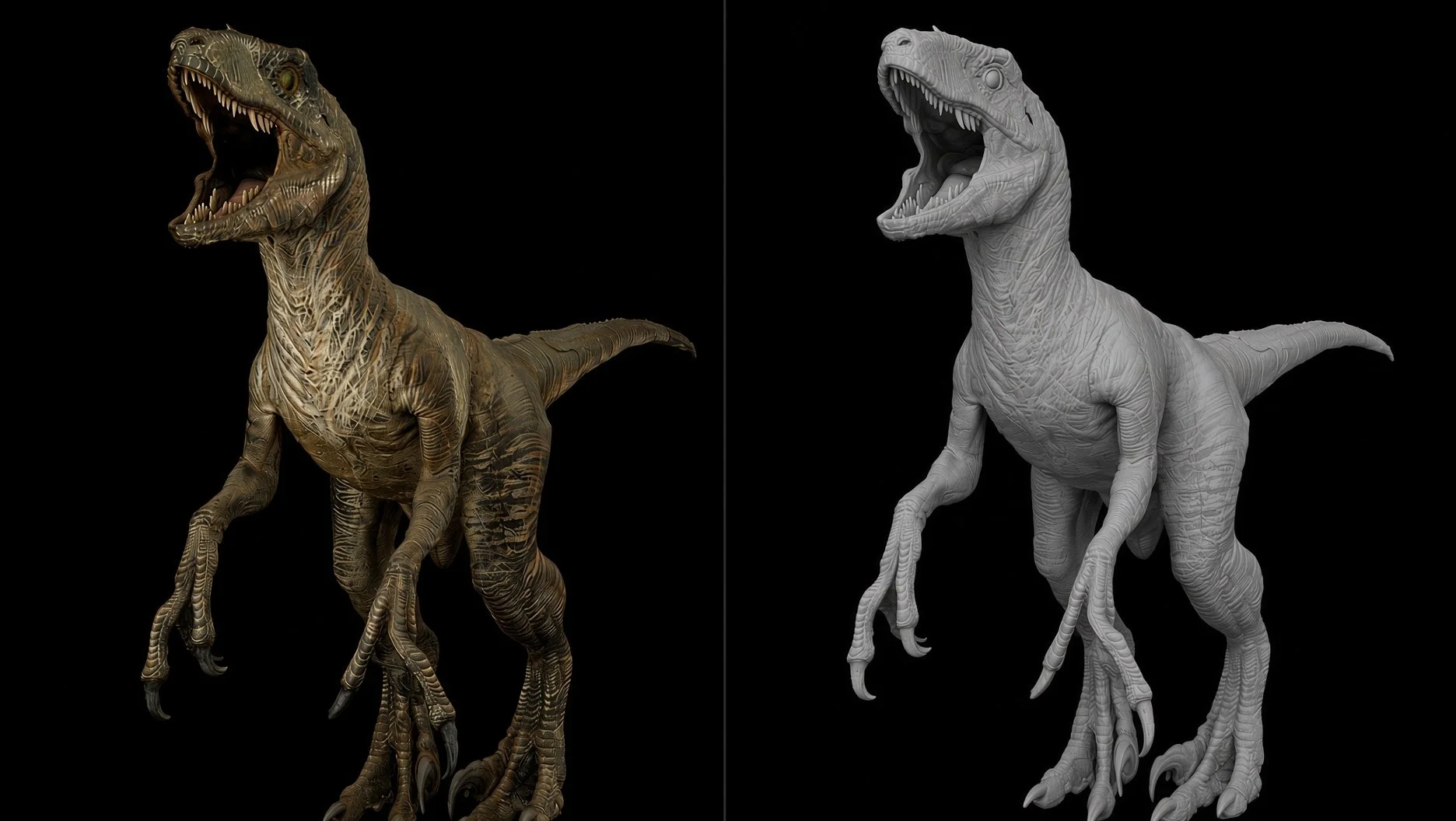
We use metrology quality, handheld Artec 3D scanners, with up to 0.050mm accuracy, and a resolution of of mm. Combined with LiDAR and high resolution photogrammetry for textures, we can provide props and object scanning with high 3D point accuracy, excellent micro-geometric fidelity, and accurately mapped textures.
Where Ideas Take Shape
Create accurate 3D replicas of props, miniatures and maquettes, and rescale them to a proper size for CNC milling or 3D printing. These models can also be used as references for creating unique 3D assets, or customized in 3D modeling software for further use in virtual production – way faster than designing them from scratch.
Shine a spotlight on your object
We meticulously capture objects of all sizes, ensuring every scratch, texture, and contour is faithfully reproduced in 3D. Perfect for hero props, set dressing, and digital archives.
Aerial Photogrammetry
We provide a reliable and scalable drone data acquisition solution, using mission planning software to plan and control drone flights. Under normal conditions, it is possible to perform an aerial scan of an area of 10.000 m° around a building (with a horizontal grid of 100 m x 100 m, and a sampling distance of 10 mm/px) in one day. All these data can be integrated with LiDAR and terrestrial photogrammetry.
Residential | Commercial | Industrial
We scan existing buildings so renovations start from what’s actually there — not old drawings. Homes, offices, and industrial sites get an as-built package you can design, coordinate, and permit against: Popular formats are .PTG or .E57 point cloud files and Autodesk Recap files in .RCS and .RCP format. A textured mesh (.OBJ), and the registered point cloud. Safer tenant work, cleaner compliance, and alterations that protect the asset instead of guessing at it.
Accurate As-Built Data CAD Drawings & BIM Models
3D laser scanners record digital measurements of sites and infrastructure in the form of a point cloud and can be used to create 2D CAD drawings and 3D BIM models that improve project workflows, shorten turnaround times, and reduce costs.
VFX Pipeline & Delivery
We can provide a daily rate, based on the images and measurements of the set or location.
Otherwise, if a production is vfx heavy, we can provide a weekly rate, and an all encompassing LiDAR package, which gives full time access to kit and crew, as well as every scan processed and delivered as part of that service: LiDAR + drone + photogrammetry, including alignment, data cleaning and the final export of the 3D model.
We can provide colored point clouds (.ply, xyz, .ptx, .las) or textured 3D geometries with UDIM or tiled textures (.obj, .abc, .fbx). The 3D geometries can be exported as triangular meshes with custom resolutions (from 1 million polygons to 100 million polygons or more).
Recent Clients







Our Partners






Contact us.
flatfivevfx@gmail.com
Los Angeles, California